Trends Directory
Find trends of anything. For Affiliates by Affiliates.
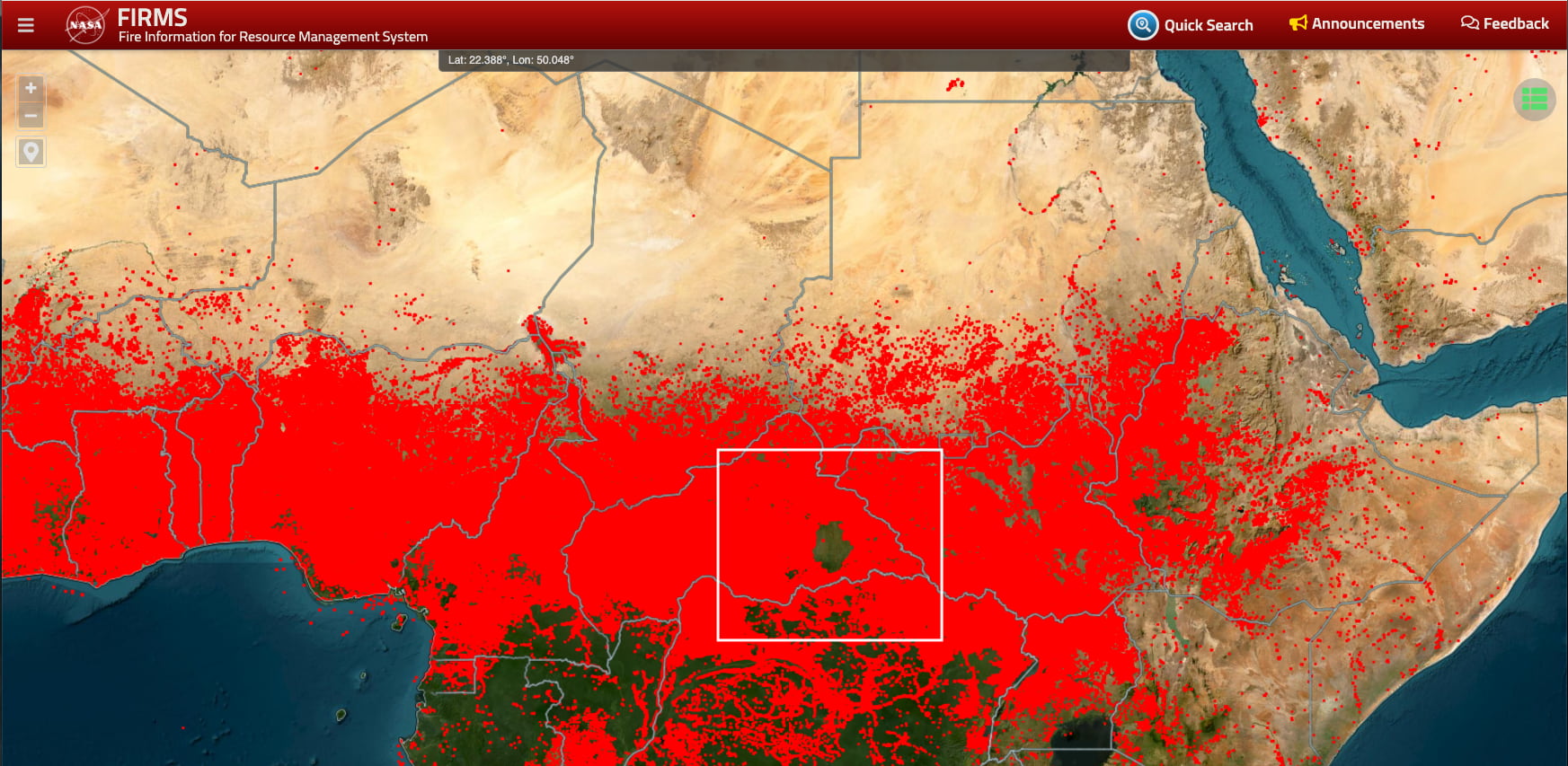
🔥 NASA Fire Map (FIRMS) — Real-Time Global Fire & Hotspot Tracker
Monitor global wildfire activity with NASA’s FIRMS Fire Map — a live satellite-powered tracker showing every active fire and thermal anomaly worldwide.
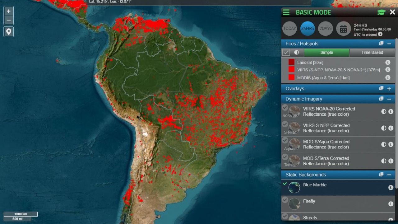
What it is: The NASA Fire Information for Resource Management System (FIRMS) is a live satellite-based wildfire and thermal anomaly tracker. Developed by NASA’s EOSDIS program, it delivers near real-time fire detections from MODIS and VIIRS satellites, helping governments, researchers, and the public monitor global fire activity 24/7.
🌍 What You Can Do on the NASA Fire Map
-
View Active Fires Worldwide: See current wildfire hotspots across continents, updated every few hours from NASA’s satellite network.
-
Customize Your Map:
- Filter by time window (last 24 hours, 48 hours, 7 days)
- Toggle satellite sources (Aqua, Terra, Suomi NPP, NOAA-20)
- Adjust layers for political boundaries, land cover, and fire radiative power (FRP)
-
Download & Analyze Data: Export fire detection data (CSV, KML, SHP) for use in GIS tools or disaster response models.
-
Track Agricultural Burns & Deforestation: Identify regional fire clusters linked to slash-and-burn agriculture, forest clearing, or industrial pollution events.
-
Access Regional Alerts: Use FIRMS’ alert system to receive near real-time fire notifications via email or API for any area of interest.
🔥 Why It Matters
NASA’s FIRMS has become one of the most trusted global tools for fire intelligence, supporting:
- 🌲 Environmental Monitoring: Tracking forest loss, peatland fires, and carbon emissions.
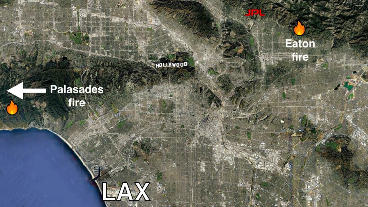
- 🚒 Emergency Response: Providing early warnings for firefighters and relief agencies.
- 🛰️ Research & Policy: Supporting climate change models and land-use policy decisions.
- 🌾 Agriculture & Air Quality: Monitoring crop burning and transboundary haze across Asia and Africa.
💡 Trend Insight
The NASA Fire Map reflects a larger trend in geo-intelligence democratization — real-time satellite data is now accessible to anyone, not just scientists. As global wildfire frequency increases, FIRMS data is powering new tools in climate analytics, AI-based fire prediction, and sustainability journalism.
✅ TL;DR
The NASA Fire Map (FIRMS) lets you see every active fire on Earth in real time, powered by NASA’s MODIS and VIIRS satellites. It’s a must-use data tool for environmental tracking, wildfire prevention, and understanding human-driven landscape change.