Trends Directory
Find trends of anything. For Affiliates by Affiliates.
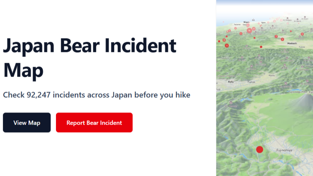
🐻 Kumamap: The Real-Time Bear Attack Tracker of Japan
Kumamap unifies over 92,000 bear incidents from across Japan into one live, English-accessible map — helping hikers and locals stay safe, informed, and one step ahead of the wild.
What It Is
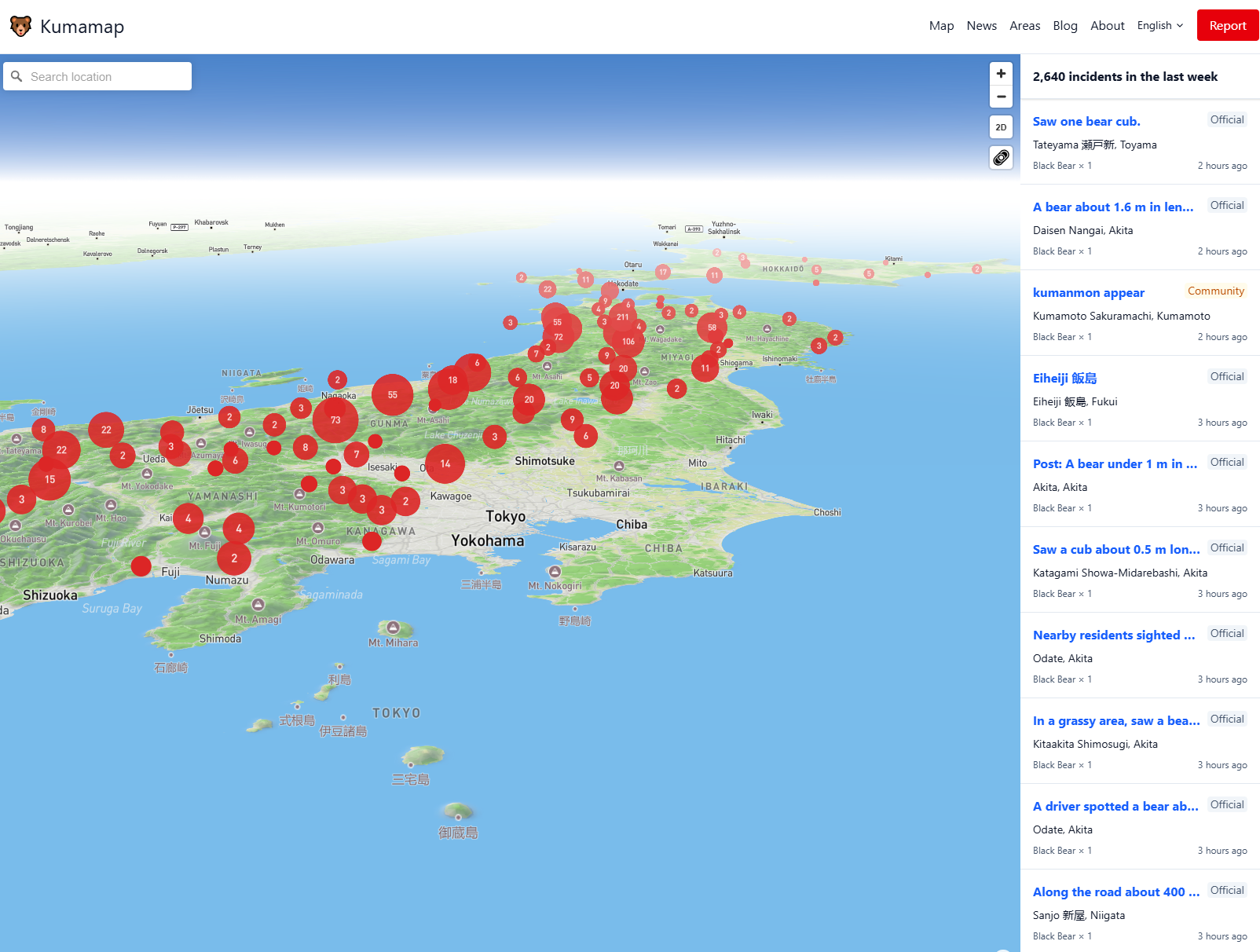
Kumamap is Japan’s centralized bear incident tracking platform, built to unify and translate wildlife encounter data from over 30 prefectural government sources. It’s the most reliable hub for monitoring bear sightings, attacks, and encounters across the country — all visualized on an interactive map.
The platform currently tracks over 92,000 bear incidents, making it the most comprehensive wildlife safety tool available to hikers, residents, and travelers in Japan.
Why It Matters
In recent years, Japan has experienced a sharp increase in bear encounters, largely due to changing ecosystems and food scarcity in mountain areas. Hikers, rural residents, and tourists need real-time information to plan routes safely — and Kumamap delivers exactly that.
For trend watchers, it’s also a fascinating data signal of human-wildlife interaction — how environmental shifts, population density, and geography affect bear movement and encounters.
Key Features
- Unified National Database: Aggregates data from 30+ prefectures into one standardized, searchable map.
- Interactive Bear Map: View all recent sightings and attacks by date, region, or proximity to your location.
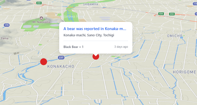
- Distance-Based Alerts: Filter incidents based on distance from your hiking trail, tourist spot, or city.
- English Translations: Auto-translates regional reports for international travelers.
- User Submissions: Locals and hikers can report new sightings to help update the system.
- Updated Twice Daily: Ensures near real-time accuracy for ongoing safety monitoring.
How to Use Kumamap
- Go to Kumamap.com — no login required.
- Zoom into your area or route (e.g., Hokkaido, Akita, Nagano).
- Check color-coded markers for recent bear encounters.
- Click any marker to see time, location, and incident type (sighting, attack, damage, etc.).
- Filter by distance to see how close incidents are to your trail or city.
- Enable English mode for instant translation of local data.
- Report sightings if you encounter or hear about new incidents — contributing to collective safety.
Trend Insight
Kumamap isn’t just a safety tool — it’s a living dataset revealing Japan’s shifting wildlife dynamics. Environmental researchers, journalists, and hikers are now using it to track long-term bear migration and human activity overlap.
It’s a perfect example of how open data and civic tech can turn fragmented regional reports into real-time national intelligence for public safety and environmental awareness.